
GEOSPATIAL
We offer Aboriginal groups web mapping tools and practical sessions building geospatial field skills
3D Models
A number of web mapping systems that Everick Foundation create, contain links to 3D models, which are representations of features which have been scanned using LiDAR in the field.
LiDAR stands for Light Detection and Ranging, remote sensing that principally measures reflected light returning to a specialised GPS receiver.
Learn more in the quick video.

Explore, engage and interact with web mapping, 3D modelling and AR
-

Web Map
Interact with a real web map based on a fictitious island. Understand the possibilities geospatial data management could open for your organisation.
Store precious cultural heritage data or traditional knowledge in an interactive, location based platform.
-

AR - Augmented Reality
Scan the QR code to see how Everick use AR technology and LiDAR scanning to recreate significant artefacts or cultural heritage and bring them to life, wherever you are.
Note: this is not a culturally scarred tree. It was created as a test case.
-
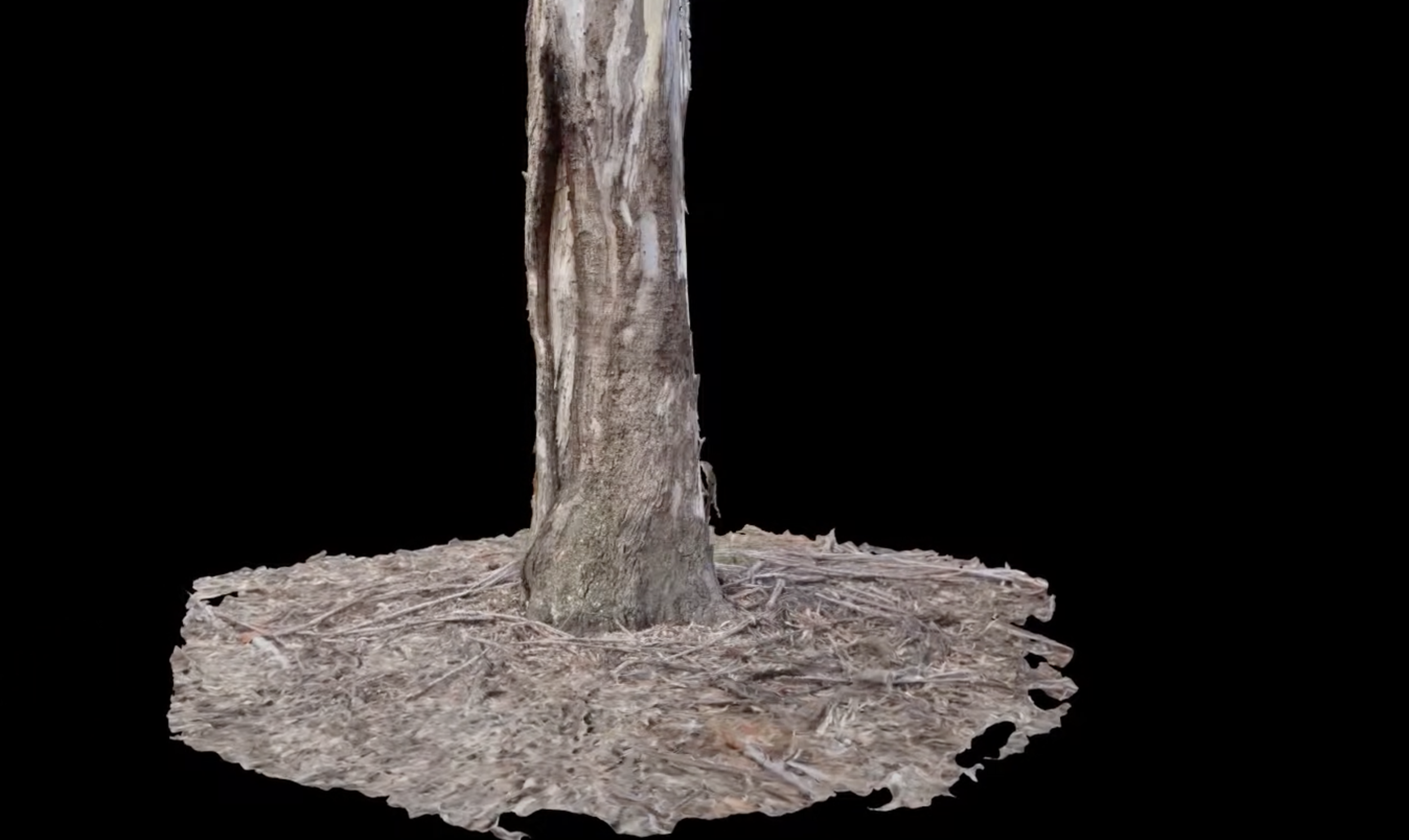
Photogrammetry
This scarred tree animation example was created using photogrammetry. The applications for this technology are exciting in the field of Indigenous cultural heritage/archaeological research. Accessible photogrammetry scans of significant sites can aid in the interpretation, management and protection of significant sites.